On the BQE…
Reading through the Brooklyn Eagle Archives about the construction of what would become the BQE and it's interesting to see how the politics worked and how in-step not only the media, but the entire NYC government were with Moses. I'm mostly curious tonight in finding out at what point the decision was made to build the Gowanus Parkway. References to it first appear in 1940 after construction was already underway, so when did they decide to build it and how was the decision to put it on 3rd Ave reported?
In January 1939 there was approval to extend the Belt Parkway north to Hamilton along 2nd Avenue. By March 1, there was "no provision yet made" for anything north of Owl's Head Park. Around the same time (March 6), the board of the Eagle gave full support for Moses plans for the Brooklyn Battery Bridge because there's no way the Brooklyn Bridge could accommodate cars, nor would anyone support a viaduct in through Downtown Brooklyn. (Love good foreshadowing.) A map published on March 16, 1939, does appear to show the Belt Parkway continuing along 2nd Avenue.

It's worth noting, I think, that most of the discussion around this time was focused on how the building of the Parkway and the Bridge would be good for the South Brooklyn Industrial sector, which is odd because trucks are not allowed on parkways...
The first mention of 3rd Avenue comes on May 26, 1939. The connection to the Brooklyn Battery Bridge would be made specifically at 3rd and Hamilton (the current nightmare intersection) but the connection to the Belt from there would be on 2nd *or* 3rd Ave. Keeping in mind that 2nd Ave was already approved, this is around the time that opposition to the Bridge was really starting to grow. While there was widespread approval earlier in the year, the paper is now starting to acknowledge that not everyone supports the idea.
By September of 1939, The Eagle was now reporting that Owl’s Head Park was the end of the Belt Parkway. All mentions to the Brooklyn Battery Bridge being part of the Parkway now apparently down the memory hole, Moses was given space to discuss how great it was that the entire Parkway would be finished by July 1940, right on time.
Around this time, the War Department reconsidered the approval of the Brooklyn Battery Bridge, considering it a potential national security risk. Their concern was simply that the bridge could easily be bombed, cutting off the Navy Yard in North Brooklyn from its sea access via the East River. In October, Mayor LaGuardia asked the president directly to force the approval of the bridge but to no avail. It’s here we see Sunset Park come back into play. On November 1, 1939, the editors of the Eagle say, “next year, when the Belt Parkway is completed up to Owl’s Head Park and it begins to discharge its hurrying streams of traffic from southern and eastern Brooklyn, Queens and points beyond into the ordinary street traffic at that point to struggle slowly on to Manhattan, the uproar of the entangled motorists will reach even to Washington.”
What’s interesting to me here is that it seems, at least apparently to the editors, that the entire Sunset Park section is contingent on the bridge. There’s no bridge, but there is a highway. Moses even gave up on the bridge around this time and started looking for ways to finance tunnel construction. So, what happened?
Well, Sunset Park comes back into the discussion with the tunnel option on November 22,1939. Despite the fact that the connection is no longer a bridge, the connection to Owl’s Head Park will still be elevated, for some reason. It’s formally announced in the paper on January 5, 1940, as an approach to the newly announced Brooklyn Battery Tunnel. No route was immediately announced, but the construction would be organized by the newly consolidated Triborough Bridge Authority, which absorbed the New York City Parkway Authority. On January 16, the elevated nature of the new but unnamed Parkway was explained as providing a route to the tunnel for industrial traffic below its spans, but the actual route was not described.
In February 1940, as plans came into clearer view, the paper reported that the “street-level truck route, under the highway [would] traverse the industrial area along the South Brooklyn Waterfront and lead to the Brooklyn outlet of the tunnel.” This is still not particularly clear but seeing as 3rd Avenue was not at this time fully industrial but was primarily a shopping, entertainment, and residential it seems as though at this point 2nd Avenue was still the primary option.
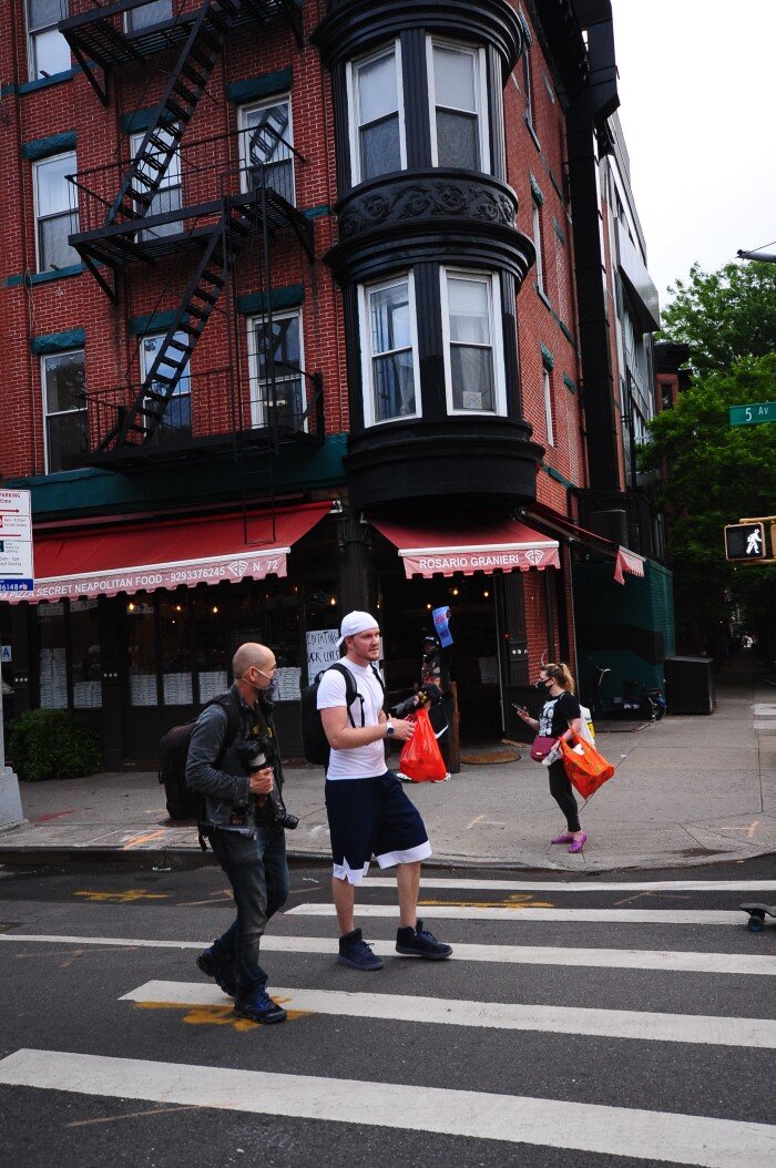
On March 12, 1940, the first reporting on 3rd Ave appears as opposition to Moses’ plan. The full article is included below.

The rest of the story is well-told in Robert Caro’s The Power Broker. The business owners and residents failed, despite support from the city comptroller and the stories in that section of the book are heartbreaking. Residents describe Third Avenue as the heart of the neighborhood, where everyone came together because they needed the train. The highway “tore [that heart] out” and replaced it with a truck route, turning 3rd Ave and its surrounding neighborhood streets from “a place for people” to “a place for cars.”
Part 2 of this series will cover the aftermath of its construction.
Publicly Owned Private Spaces
The full version of this article, including images, is available at Society and Space.
Walking along Brooklyn’s 5th Avenue one Wednesday morning, I came across an odd scene. Two police officers, peering into the window of one of the now ubiquitous outdoor dining pavilions while talking to a restaurant owner. “Was there any damage,” one of the officers asked. “No, not other than the lock.”
Someone had broken into the covered cabana and taken refuge at some point in the night. They left before the restaurant would open in the early afternoon. They did not take anything. They did not break anything. It is unclear what they did inside the space, but after a week of intense heat, violent thunderstorms, and a haze of smoke from Canadian and Western wildfires, it is safe to assume their temporary incursion offered some level of respite. A month earlier, a homeless person seeking similar respite underneath the Brooklyn-Queens Expressway, about 3 miles from the restaurant, was killed when they were struck by a vehicle looking for parking under the highway. For nearly a week in July 2021, a contingent of New York City’s homeless population are protesting at City Hall, asking for the right to stay in a hotel, for the right to not be placed back into a shelter: Rights which, for many, mean most of all the right to not be back on the street.
Technically, the shelter, like most of these spaces, sat squarely on the street. Constructed by the adjacent restaurant as part of New York City’s Open Restaurants program, the space is part of the expanded outdoor area programs created by the city in the wake of the Coronavirus pandemic (for more details see Angiello 2021). The structure itself–that is, the unique configuration of plywood, 2x framing wood, and galvanized steel quickly assembled to supply outdoor eating space during the Coronavirus pandemic–belonged to the restaurant. But what about the street itself? Who has a right to put a lock on it? To say, “this is ours and the police have the responsibility to address any incursion into this space?” What response did the business owner expect from the police in this situation?
As of June 24, 2021, the Open Restaurants program had received 11,233 applications, of which 97% (10,910) were approved. Applicants could choose to request a permit for outdoor dining only on the sidewalk (3683 approved applications), on the roadway as in the case of the temporary shelter above (1411 approved applications), or both (5816 approved applications). No one applied for both and was only approved for either one or the other, meaning all applications that requested both roadway and sidewalk space for dining were approved. Taken together, these approved applications have a total area of 5,570,222 sqFt, or about 127.87 acres.
Because access is limited to operating hours and as an extension of restaurant interiors, the program turns public space (either extant or potential) and turns it into enclosed property coded as private. This move inverts stated planning goals which seek to expand urban public space by turning these areas into publicly-owned private spaces, as opposed to the city’s 388 privately-owned public spaces or 24 Street Seats--a version of sidewalk or street dining but which are fully open to the public and not tied to a specific restaurant. Restaurant sheds were initially compared to both programs.
Because the new outdoor dining hubs sit on the roadway or sidewalk, the NYC Department of Transportation handles inspections for compliance with rules relating to spacing and construction while the Department of Health and Mental Hygiene includes the new outdoor dining areas in their standard food safety inspections as part of their regular review. Initially a sort of free-for-all, resulting in unsafe conditions for diners (CW link includes video of a truck crashing into an early outdoor dining area), New York City, New York State, and the DOT applied a standard set of rules to which all Open Restaurants must comply. As of July 1, 2021, the DOT has performed 47,804 inspections. Of the 42,737 results made available with valid location data, 8,280 (19%) were found to be non-compliant and 2,232 (5%) inspections resulted in a cease-and-desist order (there are several duplicates in each category, including those which eventually reached compliance). By comparison, 9,446 inspections resulted in locations being found to be compliant (23%).
Support for the program has been mixed. Some small business advocates have called for a permanent change to allow new dining programs (which the City Planning Commission has recently approved). At the same time, public transit advocates have highlighted the ways in which open restaurants, by virtue of reducing the amount of space dedicated to motor vehicles, counter an ongoing revanchist movement focused on making the city more car-friendly. Opposition to the program has decried both the loss of parking and the non-democratic nature of the program. The reference to cars is perhaps apt. In most cases, dining sheds do take parking spaces, and most have been built in a way to not interfere with bike lanes. Sidewalk seating reduces the amount of space on the sidewalk itself, but those are removed outside of business hours. The effect is that restaurants have parked on the street with the noted difference that they are not subject to meters or alternate side parking rules.
Taking it to the street
A society of split men and women badly needs a terrain on which people can come together to heal their inner wounds—or at least to treat them—and advance from political to human emancipation. Berman 1986, 476-477
Marshall Berman, (1986, 477) reading Marx’s “On the Jewish Question” identifies a deeply human need, particularly in the United States where “our republic inherited no splendid monuments and plazas” in which we can experience collective life. “Sometimes,” he states, “people are lucky enough to get Central Parks and Washington Squares” but even these are sites of conflict between the need for collective life and an egoistic desire for privacy, solitude, and the unique needs of individual life. Even when they act of spaces of collective jouissance, the question of who belongs never leaves. Or, as Berman (1986, 480) puts it, “anyone who wants to claim a share of public space in a modern city is forced to share it with some of the people of the underclass, and so to think about where he stands in relation to them.” What, in the context of Open Restaurants which make a claim to the public space of the street, is the relation to the underclass? Is it antagonistic? Why should it involve the police? And what do small businesses’ worries about “invasions” of such putatively private spaces say about the extent to which such space is actually public?
The reality, whether we collectively care to admit or not is that there is nothing public about them. They are intimately tied to capitalist economies, in which even the underclass could be allowed so long as they can consume. Rather than being “open” (or as Berman [1986] would state it, “open-minded”) the public space of the city’s streets and sidewalks are (en)closed; turned from public (in the case of sidewalks, see Loukaitou-Sideris and Ehrenfeucht 2009) or at the very least potential public space to something which only exists as an extension of private space into the public sphere. “Open” restaurants are able to be policed, able to be securitized, and able to be closed—a privilege rarely extended even to extant Privately-Owned Public Spaces and Street Seats in similar situations even if there are secured, securitized, and surveilled in other ways (Németh 2009; Németh and Schmidt 2011).
It didn’t have to be this way. Prior to the creation of the Open Restaurants program, people (albeit mostly white and wealthier than most of the city) had taken the streets for themselves by ordering takeout food and eating it in the public spaces that would later be taken over by Open Restaurants dining structures. For others, the street and the sidewalk had always been an open space through which members of the community could come together to celebrate, to mourn, or simply to talk. Thinking about other forms in which open space might be centered on such communal possibilities opens room for imagining a pandemic city otherwise.
Open-minded space, or the pandemic city otherwise?
When we encounter categories like success/failure or normal/deviant, we need to ask: By what criteria? By whose criteria? For what purposes? In whose interests? When we hear about successful public spaces, we should ask: Successful for what? Who benefits from a police definition of success, that is, success as an absence of trouble? Berman 1986, 481
There are more than 4,100 parks in New York City that take up less space than the area taken up by the city’s Open Restaurants program. What if the response to the pandemic was not to extend the private to the public, not to enclose streets and sidewalks, but to radically open them, to break down, as Berman (1986) suggests the dualism between the “ordinary citizen” and the “deviant” and to instead think of the city as space for all? What, then, of the pandemic city? That urban spaces required tweaks due to the Coronavirus pandemic is not controversial. That these tweaks could be made permanent, producing greener, more resilient, or just more enjoyable cities offers a useful insight for geographers and others interested in the connections between society and public space (Angiello 2021; Finn 2020). But most importantly, the ease with which space was ceded to allow for one group a semblance of normality and for another a semblance of survival shows how easy it could be to do something different, to create a city otherwise, and to take steps toward an open-minded city.
In the first photo in this essay, there is a “sharrow” in the road, indicating that cyclists and drivers must share that space. Why couldn’t the area given to restaurants have previously been made a protected bike lane? Why can’t it still? Berman (1986) argues that changes to public space cannot come from above, cannot come from the position of authority of the city planner or the mayor, that they must emerge from below. In the first months of Coronavirus pandemic, as thousands died, and before they could become restaurants the streets became morgues, people in New York City—at least those of us who stayed—found creative ways to reclaim space, to see our friends, families, and neighbors. There were moments when, experiencing a deep reckoning with the world around us—with systemic anti-Black and anti-Asian racism, with police violence, with the emergence of widespread mutual aid projects shining a spotlight on the failure of the government to address even out most basic needs—that it felt as though things might change for the better. Instead, we have only created a city with more places to police.
References
Angiello G (2021) Toward greener and pandemic-proof cities: North American cities policy responses to Covid-19 outbreak, TeMA: Journal of Land Use, Mobility and Environment, 1, 105-111. doi:10.6092/1970-9870/7922
Berman M (1986) Take it to the streets: conflict and community in public space. Dissent, 33, 476-485.
Finn D (2020) Streets, Sidewalks and COVID-19: Reimagining New York City’s Public Realm as a Tool for Crisis Management, Journal of Extreme Events, 7(4), 2150006. doi: 10.1142/S2345737621500068
Loukaitou-Sideris A. and Ehrenfeucht R (2009) Sidewalks: Conflict and Negotiation over Public Space. Cambridge, MA: MIT Press.
Németh J (2009) Defining a Public: The Management of Privately Owned Public Space, Urban Studies, 46(11), 2463–2490. doi:10.1177/0042098009342903.
Németh J and Schmidt S (2011) The Privatization of Public Space: Modeling and Measuring Publicness, Environment and Planning B: Planning and Design, 38(1), 5–23. doi:10.1068/b36057.


Visualizing the American Nightmare
It doesn’t take a lot of effort to see the nightmare of living in the United States. From the lack of basic infrastructure, including running water, to the (as of this writing) 247,834 deaths resulting from COVID-19 it’s sitting in plain sight. The nightmare is uneven in who is affected by it, making it easier to overlook, dismiss, and turn into a political talking point rather than address with concrete actions. Recently, Zbigniew Grabowski of the Urban Systems Lab at the New School for Social Research created a simple visualization of rent-burdened households in the United States. The map presents a stark image of American life in which the majority of the country, in terms of both land area and population, have more than 50% of people spending more than 25% of their income on rent.
Happy #GISDay2020! Thanks to all the mapmakers, modelers, and critical #geographers working for #climate #justice and #equity. Map of rent burden in the U.S. by @zjgrabowski https://t.co/DvJF1N6xyR pic.twitter.com/PVbsb54qHv
— Urban Systems Lab (@USL_NYC) November 18, 2020
I couldn’t help but wonder what other basic facts of the American Nightmare look like mapped? What follows are a series of simple visualizations of data from the American Community Survey along with some brief thoughts on the matter. This isn’t meant to be rigorous academic analysis, but rather an articulation of what I see when I see “America”.

There are 3,141 counties in the United States. Of these, nearly 7.5% have more than 25% of their population living below the federal poverty line ($21,720 for a three-person household.) These counties are concentrated in the US South (specifically the Black Belt and central Appalachia), the South Texas borderlands, and the same reservations experiencing plumbing poverty in the desert Southwest. Pockets appear elsewhere, but it’s not necessarily surprising that those experiencing the highest levels of poverty in the country are the people who have been targeted by US government policies focused on their extermination, removal, and subjugation. You could say it’s because it costs less to live in these areas, but they are also rent burdened.

Over 44% of US counties have between 22.8 and 79.6% of households without internet access. This is, in the best instance, about 1 and 5 people. Again, the Black Belt, Appalachia, reservations, and borderlands are among the highest areas and its completely unsurprising that there is such a strong correlation with poverty levels. But, given the widespread shift to internet usage for remote working and learning since March it becomes clear why at least some people simply cannot deal with lockdowns. I’m not referring to the people not represented by this map, who use the internet to spread easily debunked claims and to dismiss the trauma experienced as part of partisan politics, but rather those for whom it was never an option. According to the CDC, Mississippi and Louisiana have the highest death rates in the South and are well represented on this map. To what extent were those deaths the result of a lack of an alternative? People forced to continue working through a deadly pandemic, probably without adequate access to healthcare or insurance…


On (Not) Photographing Protests
The past decade has seen several major protests and liberation movements form in the United States. There’s an undeniable need and appeal to document these moments in a variety of media. Unfortunately, the visual documentation of this, particularly the documentation of legitimate expressions of rage and frustration, can be used to identify and harm those involved. In the years following the uprising in Ferguson, MO that helped kick off the Black Lives Matter movement, six people involved died mysterious deaths, leaving activists to speculate on the role of dramatic protest photography in making them identifiable. This year, the FBI and Philadelphia police used a variety of protest photos to identify a person accused of burning a police car.
This has sparked a conversation about the role photographers (including photojournalists) should play in documenting these events. One easy solution, particularly since masking laws are not being enforced due to the Coronavirus outbreak, has been to not show people’s faces. One photojournalist has decided to curate the photos they share in an effort to protect protestors by not sharing photos where faces are visible. This is a good start, but in the Philadelphia case it was a t-shirt and a tattoo, not a face, that lead to arrest, leading for a more general call for people to refrain from taking any pictures at all or to generally consider how to do so safely and responsibly by hiding faces and scrubbing metadata. All of these are good ideas, including encouraging (most) people not to take photographs. For Black photographers, however, photography allows for a control of a narrative history that has long been denied to Black people in general. As a white person, I’m certainly not going to tell Black people not to photograph events significant to their own history and as a white photographer I would like to use some of the privilege afforded to me to contribute to that storytelling.
What follows are some thoughts and my own personal considerations for photographing protests. It’s ultimately going to be up to individuals to decide for themselves how to approach a given situation. I draw on my experience in ethnography and the ethical considerations of protecting your collaborators’ rights in doing academic research and writing. Visual ethnography often falls severely short of this in practice, but the general rules guiding anonymization are good. I’ll also include some of my own photographs and my justification for sharing them. I’m certainly open to discussing these further and my views are ever-changing.
First, we shouldn’t fully relinquish the right to photograph (or video) events. The below photos were taken at various protests in Brooklyn and show police officers and suspected white supremacists taking photos and video of protestors. We’re not going to be able to stop them so long as they exist, so by relinquishing all power of visual storytelling we’re leaving it in the hands of people who are against us. Instead, we should document it ourselves and have our own version to share.
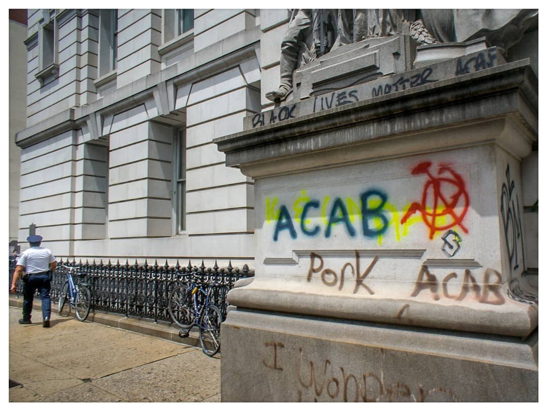
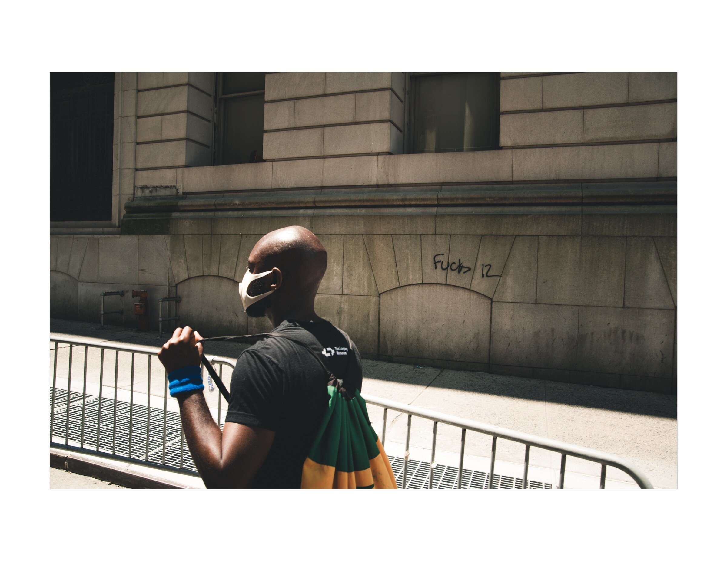
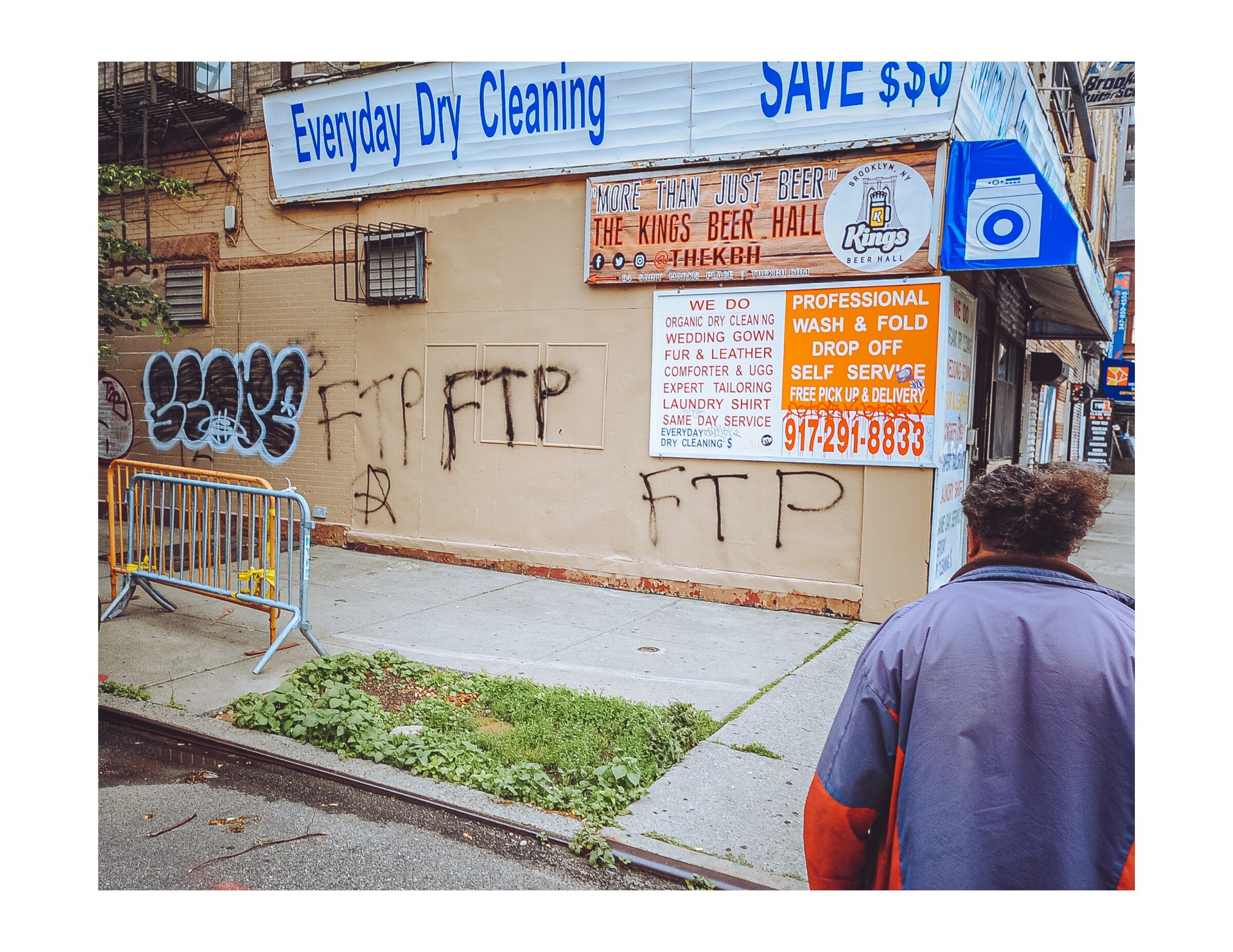
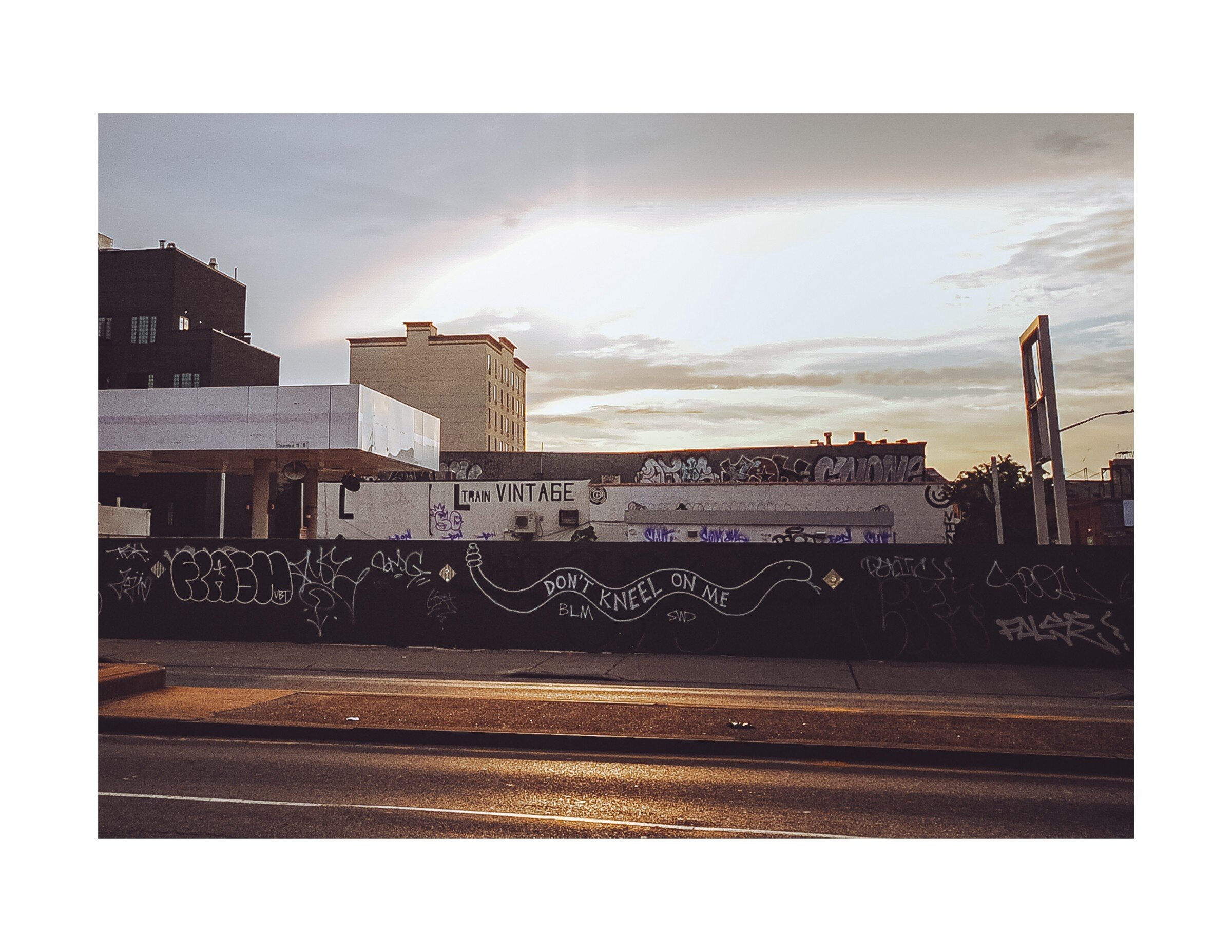
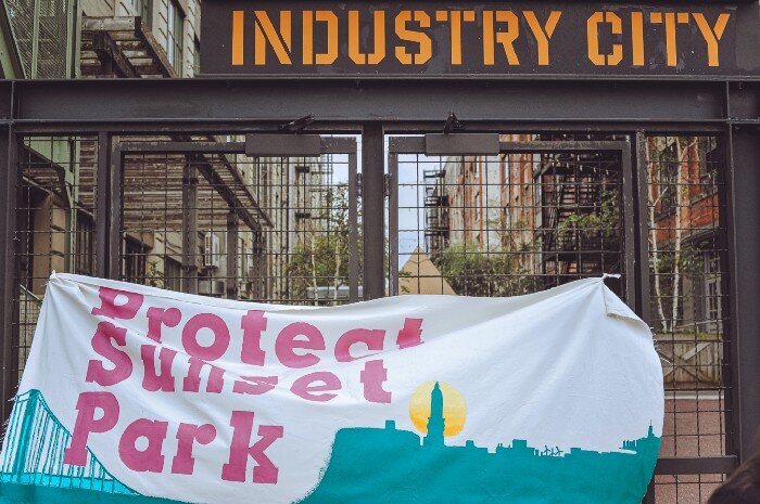
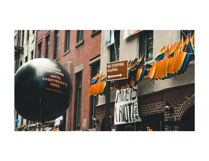
However, documenting protests for ourselves is dangerous. There’s no denying that but there are ways to mitigate it. First, by not showing who else was there. It’s always going to be obvious that we, the photographer, was present and thus we should be on our best behavior, but we can take photos that show the protest that don’t include identifiable individuals. When protestors in Sunset Park went to Industry City both to reaffirm their intent to stop their proposed rezoning and to support frontline workers who were needlessly exposed to Coronavirus, they hung a banner on the main courtyard gates. The photo of the banner itself is an interesting visual image, leaving no way to tell who, exactly, was involved. During the Queer Liberation March, the Stonewall Inn (the site of the uprising that gave way to pride) was adorned with a banner reading “Pride Is a Riot #BLM.” The image, along with the large black balloons stating “we’re not free until everybody’s free” tell a story of that march that includes no identifiable people. Likewise, the first wave of protests in Manhattan and Brooklyn left significant graffiti behind. This is usually cleaned off within days, if not hours, but likewise tells part of the story of rage. The last six photos in this section show this graffiti as part of that story. Three of them include an identifiable person, but it’s unclear if that person was part of any march or action or if they were simply walking by. Another shows a police officer, and any time is a good time to point a camera at a cop.
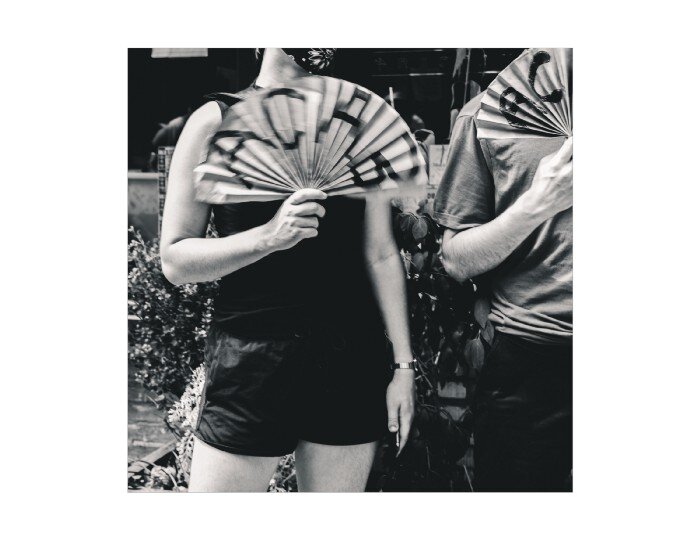
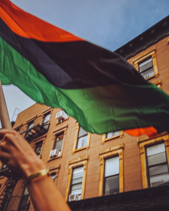
Sometimes, it’s worthwhile to include a person in an unidentifiable way. The first photo shows a person waving a red, black, and green flag at a recent protest. Both the location of the protests and the identity of the person are hidden, offering them some level of protection. In the second photo, two people have anti-police slogans written on their fans. Identifiable marks are cropped out and their clothing is fairly generic. Again, this photo could have been taken at any of a variety of protests.
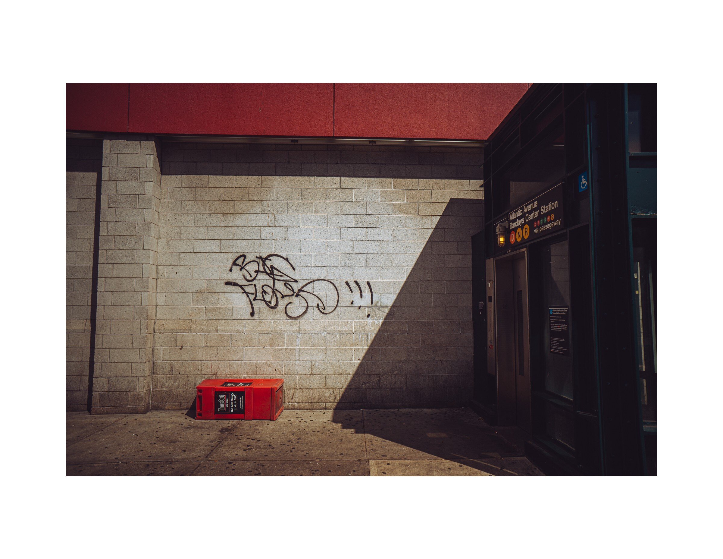
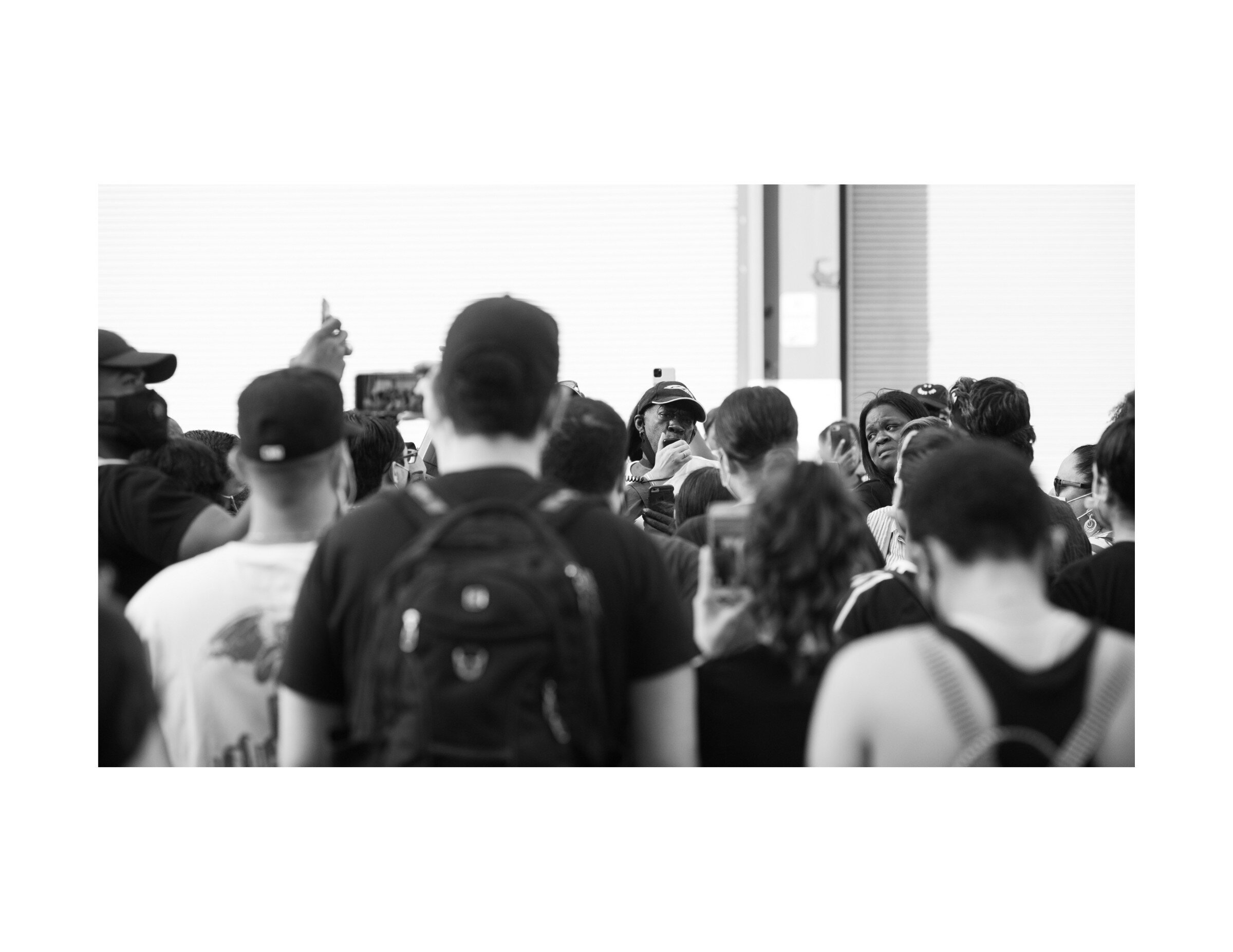
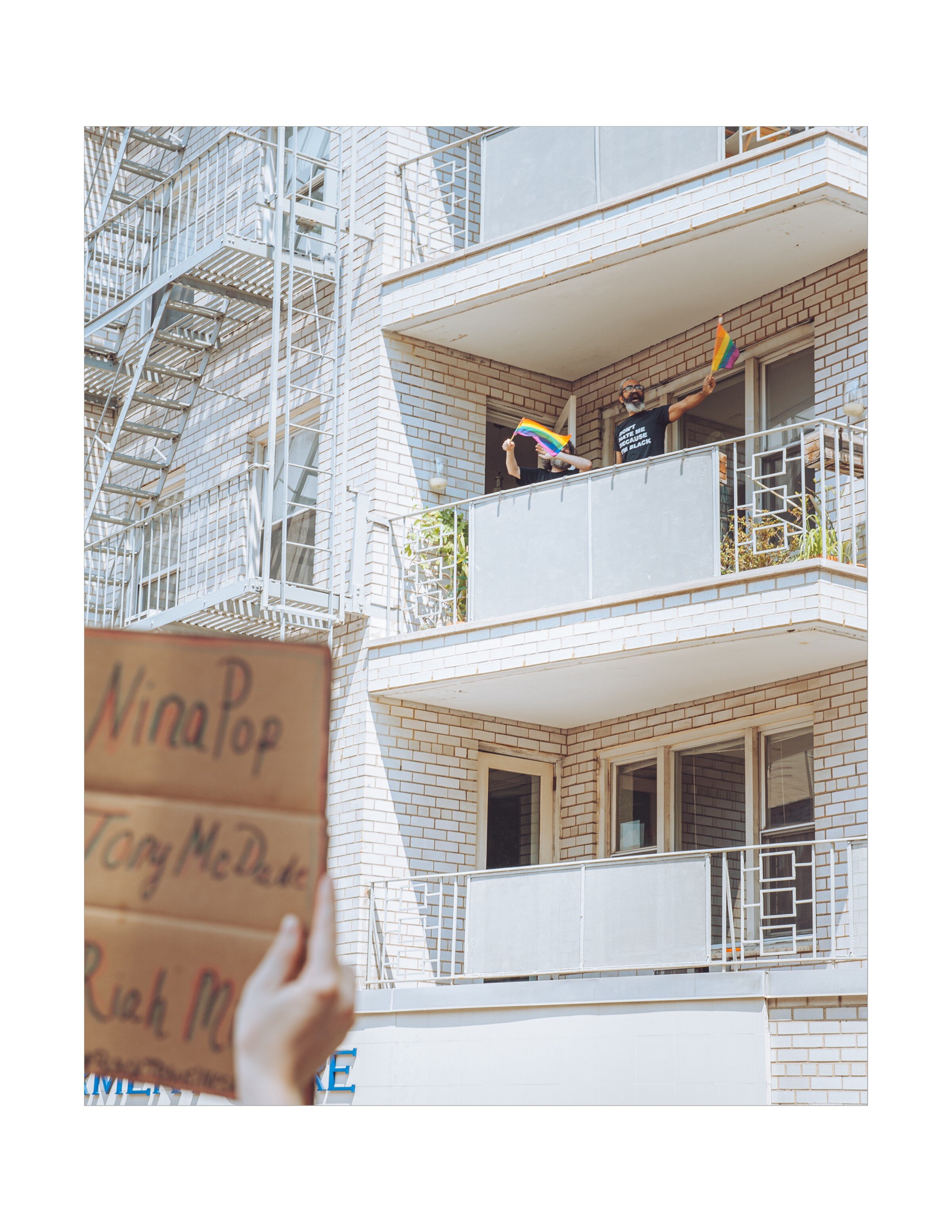
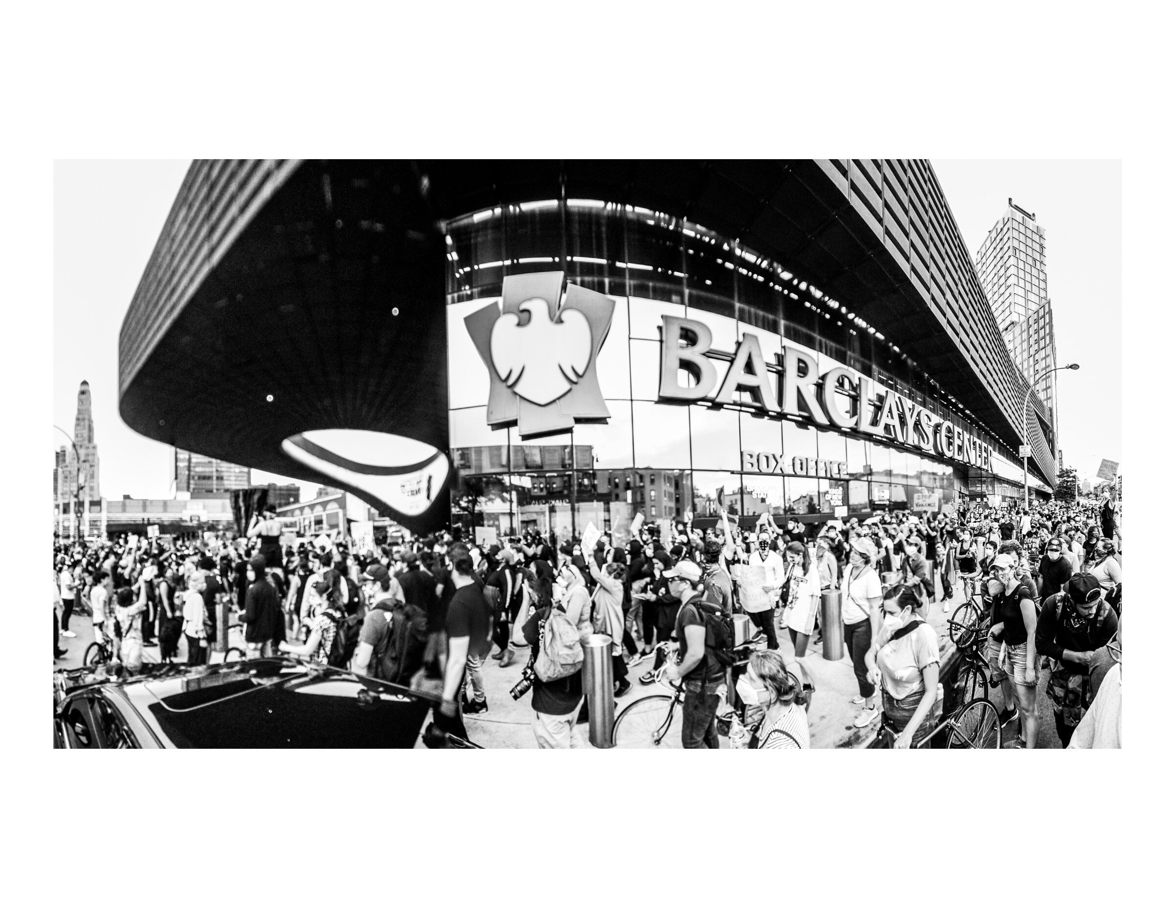
Finally, there are times when it’s important to show people but doing so requires a level of safety and recognition of what’s happening. In the first photo, protestors are shown entering the plaza at Barclays Center in Brooklyn. This photo was not published until well after the fact and when it was clear that police would not be looking for people who attended this protest. Without metadata and separated from the context of an individual action, it shows the size of the crowd without tying them to a single event. The second photo shows people not involved in the protest showing their support from their balcony. The exact location is not identifiable and the people in the photo are not directly linked to the protest below. The final image shows Jamel Floyd’s father giving an emotional speech to a crowd of supporters in front of the Metropolitan Detention Center in Brooklyn. The family were at the center of this activity and their presence was a known quantity, a shallow depth of field and the angle of the photograph were used to obscure the faces and identifying features of others.
I want to conclude with some personal dos and don’ts of photographing protests.
DO
· Use your skills and knowledge to tell important stories.
· Support and provide space for BIPOC photographers to tell their own stories.
· Photograph cops and suspected white supremacists.
· Remove all metadata associated with your pictures.
· Put some time between taking the photo and putting it online somewhere.
· Make every effort to protect the identities of the people in your photographs through creative editing and cropping, spatial and temporal dislocation, not needlessly photographing their faces.
DON’T
· Talk to or share photographs with police or FBI agents.
· Photograph illegal activities in progress.
· Take photos if you aren’t sure you can protect the people in them.
· Put people in harm’s way through your photography.
· Tag people or specific locations in your photos.
· Put aesthetics over lives.
Finally, remember that no photo — regardless of its aesthetic value — is worth a person’s life or freedom.

Taking Down Racist Monuments. All of them.
Like most multi-generational, white Floridians, my family tree is deeply entwined with Florida’s racist history. A Columbia County slave schedule dated October 12th, 1850 lists my 3rd great-grandfather, Durham Hancock, as having enslaved three people: a 22-year-old woman, a two-year-old boy, and a four-month-old girl. On the other side of that same branch, my 3rd great-grandfather Elisha Howard was a corporal in Georgia’s 52nd regiment during the Civil War.
Elisha lived near the small town of Sanderson, Florida. Sanderson was named for John Pease Sanderson, a member of Congress of the Confederate States of America. Sanderson was, at the time, part of Bradford County — named for Captain Richard Bradford, a Confederate officer. It is now in Baker County, named for James McNair Baker, another Confederate senator. In all, Florida has 7 counties named in commemoration of the Civil War and the Confederacy: Baker; Bradford; Brevard, named after Theodorus Brevard, Confederate comptroller and father of Brigadier General Theodore Brevard; Hendry, after Confederate officer Francis A. Hendry; Lee, after Robert E. Lee; Pasco, after Confederate veteran Samuel Pasco; and Dixie, named in 1921, well after “They Drove Old Dixie Down” but shortly after the peak of racist Confederate monument building.
The twigs and branches stemming from these two men form a lattice that includes confederate soldiers and veterans of the Seminole Wars (there are 6 counties memorializing people associated with that, including Miami-Dade.) There are another 15 counties named for slave holders like my 3rd great-grandfather Elisha. At final count, Florida has 28 counties that in some way memorialize people or events related to the racist and genocidal history of the state and country. Some of them are common: the founding fathers (Washington, Jefferson, Madison, Monroe, Franklin, Hamilton) are all well represented. Others are less common, like Francis “The Swamp Fox” Marion, who not-so-famously raped the women he enslaved and hunted indigenous people for fun. John C. Calhoun, who called slavery a “positive good” gets a county, too.

Debates rage about the legacy of racist monuments. Monument Avenue in Richmond, Virginia has become a hotbed of activity during the Black Lives Matter protests following the killing of George Floyd by a Minneapolis police officer. Statues of Jefferson Davis, Christopher Columbus, and Williams Carter Wickham were all pulled down by protesters. A statue of Black tennis legend Arthur Ashe was vandalized with the text “WLM,” a play on the popular shortening of Black Lives Matter that’s used by white supremacists. On the nearby campus of Virginia Commonwealth University, protesters pulled down the Confederate Howitzer statue. Meanwhile, in the United Kingdom, protesters removed a statue of slave trader Edward Colston, dumping it into the nearby river.
But this isn’t actually anything new, even in Florida. I remember the feeling of celebration when “Old Joe” was removed from his station in Gainesville, Florida early in the morning to avoid confrontations between protesters and neo-confederates. Hollywood, Florida renamed Lee, Forrest, and Hood Streets two years ago after sustained pressure by local groups. Duval County (named for William Pope Duval, who sought to remove native groups and attract plantations using enslaved labor to the state) just unanimously passed a resolution to begin renaming schools named after confederate officers. There are countless other examples from all over the world of these kinds of changes being made.
But what, if anything, should we do about these other monuments in Florida? Could there be a push to rename cities, towns, and counties and if so, what would it look like to do that in a just manner? The scale is certainly different and the level of pressure to affect change would need to be much higher, but Florida was not terra nullius prior to colonization. In fact, counties were created and renamed seemingly on a whim or over petty squabbles between landowners. Could residents work with our various indigenous groups to restore their place names? Micanopy, a small town outside of Gainesville in Alachua County is named for the Seminole leader who defeated Miami-Dade namesake Francis Dade. What would Florida’s landscape look like if other parts of the state were similarly named? I don’t have an answer, but now is the time to start posing the question.